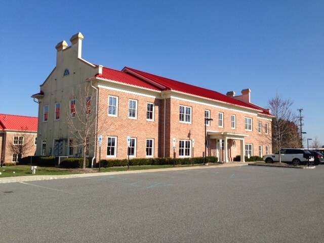
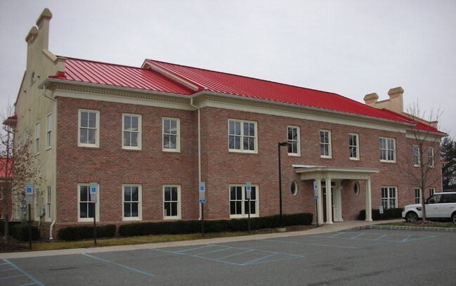
Property Record
1225 State Route 31, Lebanon, NJ 08833
NEARBY LISTINGS FOR SALE OR LEASE
Property Detail
1225 State Route 31
06-00089-0000-00005-1101-C1101
Hunterdon
Commercialnec
New Jersey
X
5
34019C0235F
0.03 AC
2024
Hunterdon
2025
Northern New Jersey
010801
Newark, NJ-PA
DEMOGRAPHICS near 1225 State Route 31
1 Mile
3 Mile
5 Mile
2024 Total Population
1,703
10,940
32,154
2029 Population
1,721
11,075
32,561
Pop Growth 2024-2029
+ 1.06%
+ 1.23%
+ 1.27%
Average Age
43
44
44
2024 Total Households
574
4,182
11,790
HH Growth 2024-2029
+ 1.05%
+ 1.34%
+ 1.46%
Median Household Inc
$172,916
$142,838
$133,902
Avg Household Size
2.90
2.60
2.60
2024 Avg HH Vehicles
3.00
2.00
2.00
Median Home Value
$554,348
$496,540
$467,222
Median Year Built
1980
1983
1980
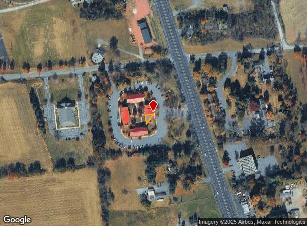
Nearby Places
Map Layers
Map Styles
 Street
 Aerial
- Restaurants
- Banks
- Shops
- Fitness
- Groceries
PUBLIC TRANSPORTATION
COMMUTER RAIL
Annandale (Raritan Valley Line - NJ Transit Commuter Rail (NJ Transit))
DRIVE
WALK
Distance
Annandale (Raritan Valley Line - NJ Transit Commuter Rail (NJ Transit))
9 min
4.2 mi
Lebanon (Raritan Valley Line - NJ Transit Commuter Rail (NJ Transit))
DRIVE
WALK
Distance
Lebanon (Raritan Valley Line - NJ Transit Commuter Rail (NJ Transit))
12 min
6.9 mi
AIRPORT
Trenton Mercer
DRIVE
WALK
Distance
Trenton Mercer
43 min
25.7 mi
Lehigh Valley International
DRIVE
WALK
Distance
Lehigh Valley International
54 min
37.0 mi
Freight Ports
Maher Terminal
DRIVE
WALK
Distance
Maher Terminal
60 min
46.8 mi
SALE & LEASE HISTORY
LISTING DATE
SALE/LEASE

Sep 24, 2016
For Sale
Jul 26, 2018
For Lease
Dec 15, 2016
For Lease
Dec 15, 2016
For Sale
Aug 05, 2017
For Sale
Nearby Properties
Address
Land Use
TOTAL SIZE
Lot Size
Zoning
Address
Land Use
TOTAL SIZE
Lot Size
Zoning
84.62 AC
ROM1
Address
Land Use
TOTAL SIZE
Lot Size
Zoning
3,703.19 AC
RC
Address
Land Use
TOTAL SIZE
Lot Size
Zoning
49.26 AC
RR4S
Address
Land Use
TOTAL SIZE
Lot Size
Zoning
6 AC
ROM1
Address
Land Use
TOTAL SIZE
Lot Size
Zoning
Address
Land Use
TOTAL SIZE
Lot Size
Zoning
9,408 SF
37 AC
ROM1
Address
Land Use
TOTAL SIZE
Lot Size
Zoning
10.20 AC
OB1
Address
Land Use
TOTAL SIZE
Lot Size
Zoning
5.24 AC
C-N
Address
Land Use
TOTAL SIZE
Lot Size
Zoning
1,620 SF
15.85 AC
C2
Address
Land Use
TOTAL SIZE
Lot Size
Zoning
11,584 SF
4.17 AC
C1
Address
Land Use
TOTAL SIZE
Lot Size
Zoning
244 SF
29.92 AC
RR4S
Address
Land Use
TOTAL SIZE
Lot Size
Zoning
7.14 AC
R-2A
Address
Land Use
TOTAL SIZE
Lot Size
Zoning
5.64 AC
C-4
Address
Land Use
TOTAL SIZE
Lot Size
Zoning
10.44 AC
PUD
Address
Land Use
TOTAL SIZE
Lot Size
Zoning
3.21 AC
C1
Address
Land Use
TOTAL SIZE
Lot Size
Zoning
16,984 SF
1.97 AC
C-4
Address
Land Use
TOTAL SIZE
Lot Size
Zoning
7.65 AC
R-3
Address
Land Use
TOTAL SIZE
Lot Size
Zoning
2,087 SF
4.12 AC
ROM2
Address
Land Use
TOTAL SIZE
Lot Size
Zoning
6,618 SF
43.45 AC
RC
Address
Land Use
TOTAL SIZE
Lot Size
Zoning
169.33 AC
RC
Address
Land Use
TOTAL SIZE
Lot Size
Zoning
5.80 AC
OB1
Address
Land Use
TOTAL SIZE
Lot Size
Zoning
98.91 AC
ROM1
Address
Land Use
TOTAL SIZE
Lot Size
Zoning
24.14 AC
AR-7
Address
Land Use
TOTAL SIZE
Lot Size
Zoning
15,876 SF
1.94 AC
ROM1
Address
Land Use
TOTAL SIZE
Lot Size
Zoning
3.20 AC
OB2
Address
Land Use
TOTAL SIZE
Lot Size
Zoning
22,358 SF
2.81 AC
C1
Address
Land Use
TOTAL SIZE
Lot Size
Zoning
3,683 SF
4.84 AC
C1
Address
Land Use
TOTAL SIZE
Lot Size
Zoning
8,148 SF
7.75 AC
R-1
Address
Land Use
TOTAL SIZE
Lot Size
Zoning
11,460 SF
2 AC
RR50
Address
Land Use
TOTAL SIZE
Lot Size
Zoning
5,058 SF
2.43 AC
C1
The World's #1 Commercial Real Estate Marketplace
Connect with us
© 2025 CoStar Group
The information above has been obtained from sources believed reliable. While we do not doubt its accuracy we have not verified it and make no guarantee, warranty or representation about it. It is your responsibility to independently confirm its accuracy and completeness. Any projections, opinions, assumptions, or estimates used are for example only and do not represent the current or future performance of the property. The value of this transaction to you depends on tax and other factors which should be evaluated by your tax, financial, and legal advisors. You and your advisors should conduct a careful, independent investigation of the property to determine to your satisfaction the suitability of the property for your needs.